

Development Lands,
Pakenhamhall Road, Green Street, Castlepollard
Agricultural Land
Asking Price €725,000
Property Overview
Status
For Sale
Land Type
Agricultural Land
Property Financials
Price
Asking Price €725,000
Property Engagement
Views Last 7 Days
20
Views Last 30 Days
97
Views All Time
1,501
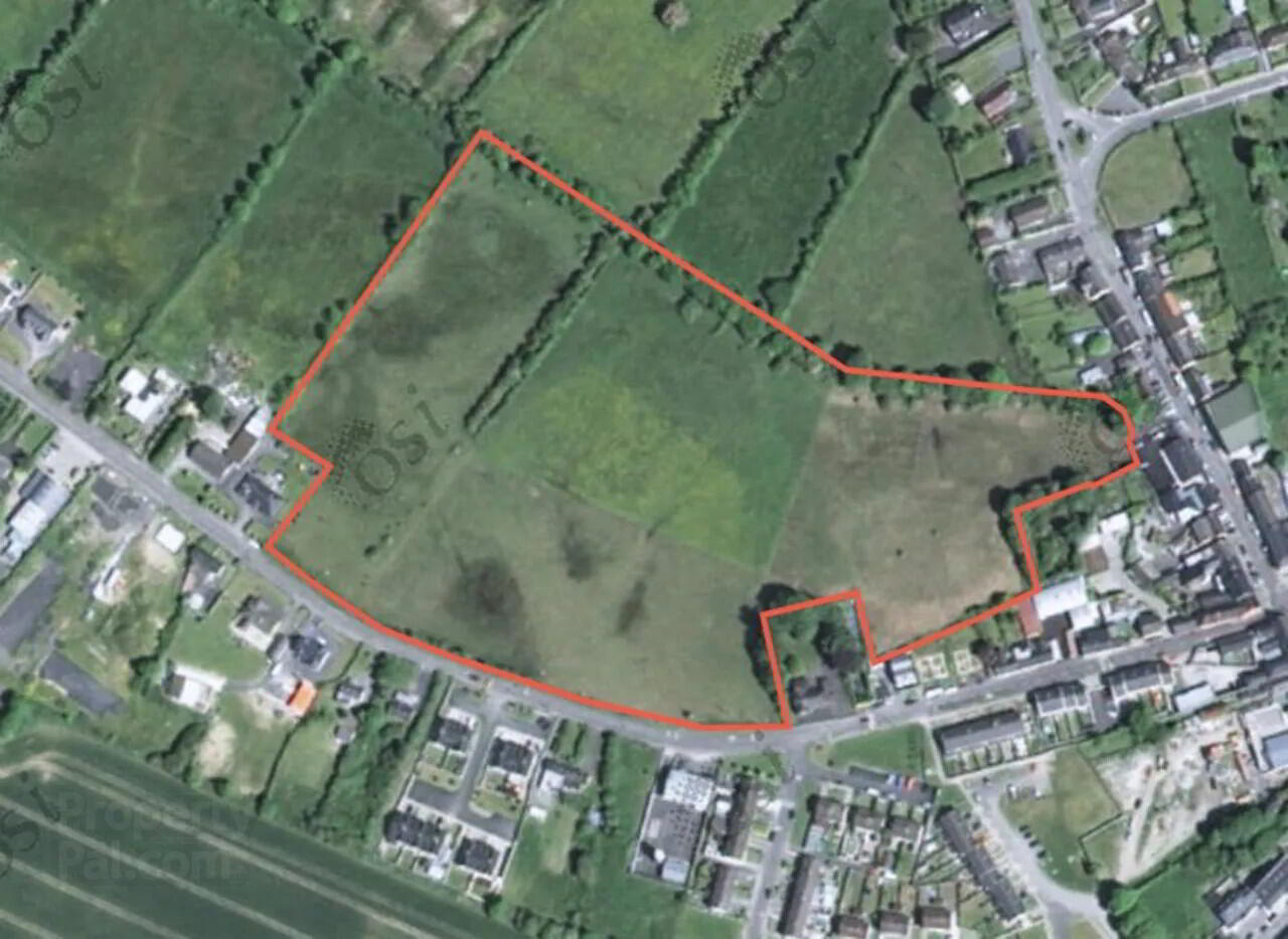
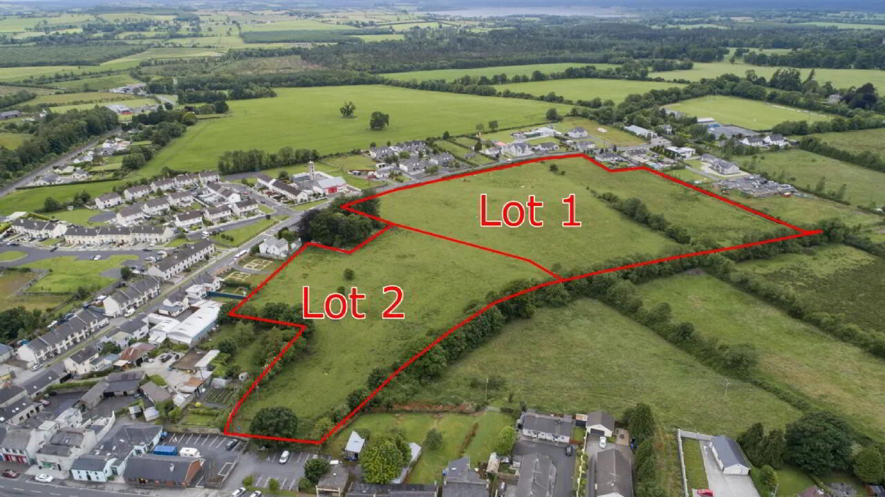
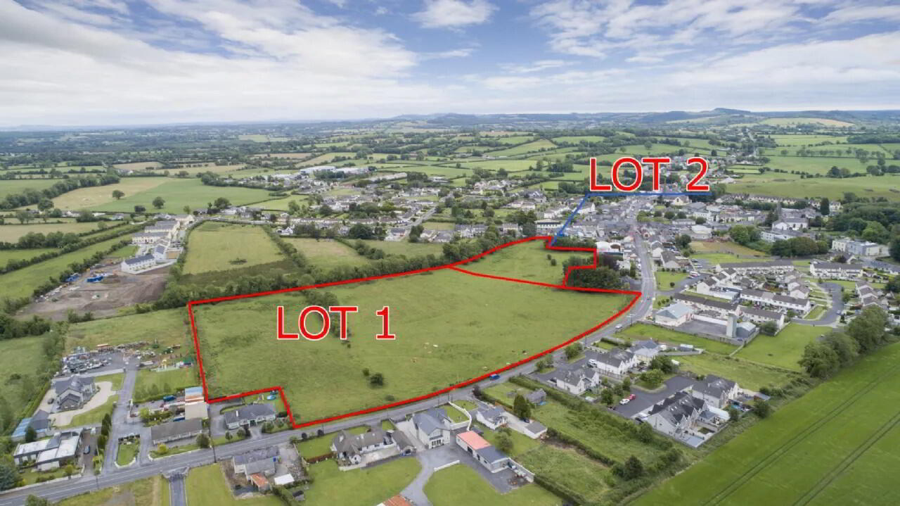
 13.5 acres approx of prime development land zoned mixed use. The site had planning permission for 162 mix residental units in 2004 and has 300 metres of road frontage.
 Since this date the planing has lapsed and also the zoning on the land has changed to the following:
-6.3 Acres zoned Consolidation Site. (Lot 1)
-3.3 Acres Agricultural Land. (Lot 1)
-2.6 Acres zoned Expanded Settlement Centre. (Lot 2)
-0.6 Acres zoned Educational. (Lot 2)
-0.6 Acres zoned Existing Residential. (Lot 2)
Planning consisted of 162 dwellings, comprised of: 130 no. Dwelling houses (17 single-storey, 48 dormer and 65 two storey houses), 32 apartments in two-storey blocks, one single storey creche and the demolition of an existing single-storey, social welfare office on green street. The development includes new roads, an effluent pumping station, related and ancillary services accessed from two new site entrances in 2005.
Castlepollard (Irish: Cionn Toirc) is a large village in north County Westmeath. It lies west of Lough Lene and northeast of Lough Derravaragh and Mullingar. Bus Éireann route 111 serves Castlepollard at frequent intervals, linking it to Dublin, Trim, Athboy, Delvin, Abbeylara, Granard and Cavan. The town has a good retail base, and is a vibrant commercial centre for North Westmeath, consisting of Filling Stations, Banks, Post Office, Council Buildings, primary and secondary schools, a number of Grocery/Newsagent Shops, Hairdressers, Beauty Salon's, Boutiques, Drapery stores, Furniture stores, Pharmacy's and a large Hardware store. Castlepollard also has number of pubs and a hotel.

